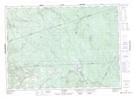
Maps showing Second Elliott Brook, Carleton, New Brunswick
Second Elliott Brook is a River located in Carleton, New Brunswick and has an elevation of 420 meters.
- Latitude: 46° 38' 25'' North (decimal: 46.6403111)
- Longitude: 67° 22' 39'' West (decimal: -67.3774598)
- Topography Feature Category: River
- Geographical Feature: Brook
- Canadian Province/Territory: New Brunswick
- Elevation: 420 meters
- Location: Carleton
- Atlas of Canada Locator Map: Second Elliott Brook
- GPS Coordinate Locator Map: Second Elliott Brook Lat/Long