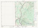
Maps showing Four Falls Stream, Victoria, New Brunswick
Four Falls Stream is a River located in Victoria, New Brunswick and has an elevation of 163 meters.
- Latitude: 46° 50' 55'' North (decimal: 46.8486386)
- Longitude: 67° 44' 50'' West (decimal: -67.7471738)
- Topography Feature Category: River
- Geographical Feature: Stream
- Canadian Province/Territory: New Brunswick
- Elevation: 163 meters
- Location: Victoria
- Atlas of Canada Locator Map: Four Falls Stream
- GPS Coordinate Locator Map: Four Falls Stream Lat/Long
Four Falls Stream NTS Map Sheets