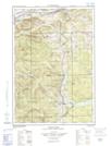
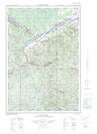
Maps showing Foley Island, Madawaska, New Brunswick
Foley Island is a Island located in Madawaska, New Brunswick and has an elevation of 185 meters.
- Latitude: 47° 11' 9'' North (decimal: 47.1859468)
- Longitude: 68° 52' 49'' West (decimal: -68.8803084)
- Topography Feature Category: Island
- Geographical Feature: Island
- Canadian Province/Territory: New Brunswick
- Elevation: 185 meters
- Location: Madawaska
- Atlas of Canada Locator Map: Foley Island
- GPS Coordinate Locator Map: Foley Island Lat/Long
Foley Island NTS Map Sheets