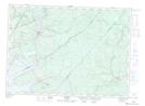
Maps showing Foley Meadow Brook, Queens, New Brunswick
Foley Meadow Brook is a River located in Queens, New Brunswick and has an elevation of 56 meters.
- Latitude: 46° 8' 19'' North (decimal: 46.1386958)
- Longitude: 65° 32' 28'' West (decimal: -65.5411573)
- Topography Feature Category: River
- Geographical Feature: Brook
- Canadian Province/Territory: New Brunswick
- Elevation: 56 meters
- Location: Queens
- Atlas of Canada Locator Map: Foley Meadow Brook
- GPS Coordinate Locator Map: Foley Meadow Brook Lat/Long