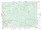
Maps showing The Forks, Carleton, New Brunswick
The Forks is a River feature located in Carleton, New Brunswick and has an elevation of 259 meters.
- Latitude: 46° 31' 8'' North (decimal: 46.5188254)
- Longitude: 67° 9' 10'' West (decimal: -67.1526559)
- Topography Feature Category: River feature
- Geographical Feature: Forks
- Canadian Province/Territory: New Brunswick
- Elevation: 259 meters
- Location: Carleton
- Atlas of Canada Locator Map: The Forks
- GPS Coordinate Locator Map: The Forks Lat/Long