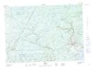
Maps showing Clare Brook Deadwater, Sunbury, New Brunswick
Clare Brook Deadwater is a River feature located in Sunbury, New Brunswick and has an elevation of 118 meters.
- Latitude: 46° 7' 26'' North (decimal: 46.1237566)
- Longitude: 66° 20' 31'' West (decimal: -66.3418440)
- Topography Feature Category: River feature
- Geographical Feature: Deadwater
- Canadian Province/Territory: New Brunswick
- Elevation: 118 meters
- Location: Sunbury
- Atlas of Canada Locator Map: Clare Brook Deadwater
- GPS Coordinate Locator Map: Clare Brook Deadwater Lat/Long