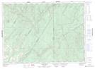
Maps showing Fourche à Clark, Madawaska, New Brunswick
Fourche à Clark is a River located in Madawaska, New Brunswick and has an elevation of 231 meters.
- Latitude: 47° 20' 30'' North (decimal: 47.3415674)
- Longitude: 67° 55' 12'' West (decimal: -67.9198875)
- Topography Feature Category: River
- Geographical Feature: Fourche
- Canadian Province/Territory: New Brunswick
- Elevation: 231 meters
- Location: Madawaska
- Atlas of Canada Locator Map: Fourche à Clark
- GPS Coordinate Locator Map: Fourche à Clark Lat/Long
Fourche à Clark NTS Map Sheets