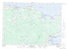
Maps showing Shemogue, Westmorland, New Brunswick
Shemogue is a Unincorporated area located in Westmorland, New Brunswick and has an elevation of 13 meters.
- Latitude: 46° 9' 22'' North (decimal: 46.1562487)
- Longitude: 64° 11' 8'' West (decimal: -64.185422)
- Topography Feature Category: Unincorporated area
- Geographical Feature: Dispersed Rural Community
- Canadian Province/Territory: New Brunswick
- Elevation: 13 meters
- Location: Westmorland
- Atlas of Canada Locator Map: Shemogue
- GPS Coordinate Locator Map: Shemogue Lat/Long