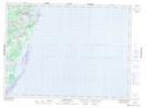
Maps showing French Cove, Northumberland, New Brunswick
French Cove is a Bay located in Northumberland, New Brunswick and has an elevation of 4 meters.
- Latitude: 47° 19' 33'' North (decimal: 47.3257568)
- Longitude: 64° 59' 40'' West (decimal: -64.9943742)
- Topography Feature Category: Bay
- Geographical Feature: Cove
- Canadian Province/Territory: New Brunswick
- Elevation: 4 meters
- Location: Northumberland
- Atlas of Canada Locator Map: French Cove
- GPS Coordinate Locator Map: French Cove Lat/Long
French Cove NTS Map Sheets