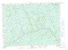
Maps showing Gaspereau Island, York, New Brunswick
Gaspereau Island is a Island located in York, New Brunswick and has an elevation of 187 meters.
- Latitude: 46° 35' 12'' North (decimal: 46.5865742)
- Longitude: 66° 41' 52'' West (decimal: -66.6977477)
- Topography Feature Category: Island
- Geographical Feature: Island
- Canadian Province/Territory: New Brunswick
- Elevation: 187 meters
- Location: York
- Atlas of Canada Locator Map: Gaspereau Island
- GPS Coordinate Locator Map: Gaspereau Island Lat/Long
Gaspereau Island NTS Map Sheets