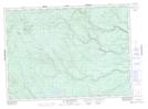
Maps showing Gill Brook, Northumberland, New Brunswick
Gill Brook is a River located in Northumberland, New Brunswick and has an elevation of 337 meters.
- Latitude: 47° 14' 40'' North (decimal: 47.2444012)
- Longitude: 66° 12' 45'' West (decimal: -66.2126131)
- Topography Feature Category: River
- Geographical Feature: Brook
- Canadian Province/Territory: New Brunswick
- Elevation: 337 meters
- Location: Northumberland
- Atlas of Canada Locator Map: Gill Brook
- GPS Coordinate Locator Map: Gill Brook Lat/Long
Gill Brook NTS Map Sheets