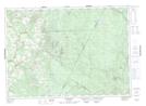
Maps showing Becaguimec Forks, Carleton, New Brunswick
Becaguimec Forks is a River feature located in Carleton, New Brunswick and has an elevation of 105 meters.
- Latitude: 46° 17' 10'' North (decimal: 46.2861926)
- Longitude: 67° 21' 57'' West (decimal: -67.3658279)
- Topography Feature Category: River feature
- Geographical Feature: Forks
- Canadian Province/Territory: New Brunswick
- Elevation: 105 meters
- Location: Carleton
- Atlas of Canada Locator Map: Becaguimec Forks
- GPS Coordinate Locator Map: Becaguimec Forks Lat/Long
Becaguimec Forks NTS Map Sheets