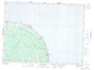
Maps showing Belledune Station, Gloucester, New Brunswick
Belledune Station is a Unincorporated area located in Gloucester, New Brunswick and has an elevation of 29 meters.
- Latitude: 47° 52' 14'' North (decimal: 47.8705939)
- Longitude: 65° 49' 13'' West (decimal: -65.8201415)
- Topography Feature Category: Unincorporated area
- Geographical Feature: Railway Point
- Canadian Province/Territory: New Brunswick
- Elevation: 29 meters
- Location: Gloucester
- Atlas of Canada Locator Map: Belledune Station
- GPS Coordinate Locator Map: Belledune Station Lat/Long
Belledune Station NTS Map Sheets