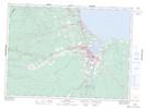
Maps showing Belloni Point, Gloucester, New Brunswick
Belloni Point is a Cape located in Gloucester, New Brunswick and has an elevation of 3 meters.
- Latitude: 47° 40' 5'' North (decimal: 47.6681142)
- Longitude: 65° 34' 13'' West (decimal: -65.5702683)
- Topography Feature Category: Cape
- Geographical Feature: Point
- Canadian Province/Territory: New Brunswick
- Elevation: 3 meters
- Location: Gloucester
- Atlas of Canada Locator Map: Belloni Point
- GPS Coordinate Locator Map: Belloni Point Lat/Long