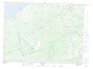
Maps showing Big Bear Brook, Gloucester, New Brunswick
Big Bear Brook is a River located in Gloucester, New Brunswick and has an elevation of 71 meters.
- Latitude: 47° 29' 37'' North (decimal: 47.4936958)
- Longitude: 65° 11' 19'' West (decimal: -65.1887425)
- Topography Feature Category: River
- Geographical Feature: Brook
- Canadian Province/Territory: New Brunswick
- Elevation: 71 meters
- Location: Gloucester
- Atlas of Canada Locator Map: Big Bear Brook
- GPS Coordinate Locator Map: Big Bear Brook Lat/Long
Big Bear Brook NTS Map Sheets