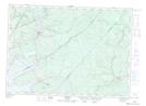
Maps showing Coal Creek, Queens, New Brunswick
Coal Creek is a Unincorporated area located in Queens, New Brunswick and has an elevation of 17 meters.
- Latitude: 46° 5' 57'' North (decimal: 46.0991580)
- Longitude: 65° 52' 55'' West (decimal: -65.8819422)
- Topography Feature Category: Unincorporated area
- Geographical Feature: Dispersed Rural Community
- Canadian Province/Territory: New Brunswick
- Elevation: 17 meters
- Location: Queens
- Atlas of Canada Locator Map: Coal Creek
- GPS Coordinate Locator Map: Coal Creek Lat/Long