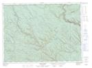
Maps showing Mount Connely, Restigouche, New Brunswick
Mount Connely is a Mountain located in Restigouche, New Brunswick and has an elevation of 504 meters.
- Latitude: 47° 54' 43'' North (decimal: 47.9118921)
- Longitude: 67° 45' 44'' West (decimal: -67.7621692)
- Topography Feature Category: Mountain
- Geographical Feature: Mount
- Canadian Province/Territory: New Brunswick
- Elevation: 504 meters
- Location: Restigouche
- Atlas of Canada Locator Map: Mount Connely
- GPS Coordinate Locator Map: Mount Connely Lat/Long
Mount Connely NTS Map Sheets