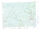
Maps showing Slope Road, Sunbury, New Brunswick
Slope Road is a Unincorporated area located in Sunbury, New Brunswick and has an elevation of 57 meters.
- Latitude: 46° 5' 35'' North (decimal: 46.0931643)
- Longitude: 66° 5' 59'' West (decimal: -66.0995988)
- Topography Feature Category: Unincorporated area
- Geographical Feature: Dispersed Rural Community
- Canadian Province/Territory: New Brunswick
- Elevation: 57 meters
- Location: Sunbury
- Atlas of Canada Locator Map: Slope Road
- GPS Coordinate Locator Map: Slope Road Lat/Long