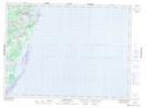
Maps showing Somersons Pond, Northumberland, New Brunswick
Somersons Pond is a Lake located in Northumberland, New Brunswick and has an elevation of 15 meters.
- Latitude: 47° 24' 57'' North (decimal: 47.4159077)
- Longitude: 64° 55' 37'' West (decimal: -64.9268901)
- Topography Feature Category: Lake
- Geographical Feature: Pond
- Canadian Province/Territory: New Brunswick
- Elevation: 15 meters
- Location: Northumberland
- Atlas of Canada Locator Map: Somersons Pond
- GPS Coordinate Locator Map: Somersons Pond Lat/Long
Somersons Pond NTS Map Sheets