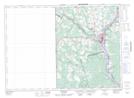
Maps showing Grafton Cove, Carleton, New Brunswick
Grafton Cove is a Bay located in Carleton, New Brunswick and has an elevation of 70 meters.
- Latitude: 46° 9' 14'' North (decimal: 46.1538468)
- Longitude: 67° 33' 54'' West (decimal: -67.5650072)
- Topography Feature Category: Bay
- Geographical Feature: Cove
- Canadian Province/Territory: New Brunswick
- Elevation: 70 meters
- Location: Carleton
- Atlas of Canada Locator Map: Grafton Cove
- GPS Coordinate Locator Map: Grafton Cove Lat/Long
Grafton Cove NTS Map Sheets