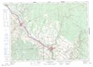
Maps showing Coombes Road, Madawaska, New Brunswick
Coombes Road is a Unincorporated area located in Madawaska, New Brunswick and has an elevation of 298 meters.
- Latitude: 47° 11' 37'' North (decimal: 47.1936803)
- Longitude: 67° 46' 10'' West (decimal: -67.7693724)
- Topography Feature Category: Unincorporated area
- Geographical Feature: Dispersed Rural Community
- Canadian Province/Territory: New Brunswick
- Elevation: 298 meters
- Location: Madawaska
- Atlas of Canada Locator Map: Coombes Road
- GPS Coordinate Locator Map: Coombes Road Lat/Long
Coombes Road NTS Map Sheets