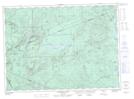
Maps showing County Line Mountain, Victoria; Northumberland, New Brunswick
County Line Mountain is a Mountain located in Victoria; Northumberland, New Brunswick and has an elevation of 477 meters.
- Latitude: 47° 16' 39'' North (decimal: 47.2774648)
- Longitude: 66° 59' 27'' West (decimal: -66.9909266)
- Topography Feature Category: Mountain
- Geographical Feature: Mountain
- Canadian Province/Territory: New Brunswick
- Elevation: 477 meters
- Location: Victoria; Northumberland
- Atlas of Canada Locator Map: County Line Mountain
- GPS Coordinate Locator Map: County Line Mountain Lat/Long
County Line Mountain NTS Map Sheets