Maps showing Couturier Siding, Madawaska, New Brunswick
Couturier Siding is a Unincorporated area located in Madawaska, New Brunswick and has an elevation of 169 meters.
- Latitude: 47° 18' 13'' North (decimal: 47.3036102)
- Longitude: 68° 29' 40'' West (decimal: -68.4945085)
- Topography Feature Category: Unincorporated area
- Geographical Feature: Railway Point
- Canadian Province/Territory: New Brunswick
- Elevation: 169 meters
- Location: Madawaska
- Atlas of Canada Locator Map: Couturier Siding
- GPS Coordinate Locator Map: Couturier Siding Lat/Long
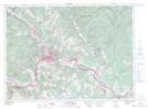
Couturier Siding NTS Map Sheets