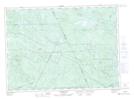
Maps showing Cow Bay, Northumberland, New Brunswick
Cow Bay is a Bay located in Northumberland, New Brunswick and has an elevation of 344 meters.
- Latitude: 46° 57' 16'' North (decimal: 46.9544910)
- Longitude: 66° 37' 39'' West (decimal: -66.6275173)
- Topography Feature Category: Bay
- Geographical Feature: Bay
- Canadian Province/Territory: New Brunswick
- Elevation: 344 meters
- Location: Northumberland
- Atlas of Canada Locator Map: Cow Bay
- GPS Coordinate Locator Map: Cow Bay Lat/Long
Cow Bay NTS Map Sheets