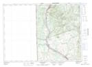
Maps showing Craig Falls, Carleton, New Brunswick
Craig Falls is a Falls located in Carleton, New Brunswick and has an elevation of 300 meters.
- Latitude: 46° 38' 21'' North (decimal: 46.6392247)
- Longitude: 67° 30' 28'' West (decimal: -67.5078654)
- Topography Feature Category: Falls
- Geographical Feature: Falls
- Canadian Province/Territory: New Brunswick
- Elevation: 300 meters
- Location: Carleton
- Atlas of Canada Locator Map: Craig Falls
- GPS Coordinate Locator Map: Craig Falls Lat/Long
Craig Falls NTS Map Sheets