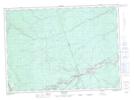
Maps showing South Branch Deadwater, Northumberland, New Brunswick
South Branch Deadwater is a River feature located in Northumberland, New Brunswick and has an elevation of 206 meters.
- Latitude: 46° 34' 34'' North (decimal: 46.5761408)
- Longitude: 66° 27' 22'' West (decimal: -66.4559975)
- Topography Feature Category: River feature
- Geographical Feature: Deadwater
- Canadian Province/Territory: New Brunswick
- Elevation: 206 meters
- Location: Northumberland
- Atlas of Canada Locator Map: South Branch Deadwater
- GPS Coordinate Locator Map: South Branch Deadwater Lat/Long