Maps showing Stanley, York, New Brunswick
Stanley is a Village located in York, New Brunswick and has an elevation of 128 meters.
- Latitude: 46° 17' 4'' North (decimal: 46.2843999)
- Longitude: 66° 43' 24'' West (decimal: -66.7232999)
- Topography Feature Category: Village
- Geographical Feature: Village
- Canadian Province/Territory: New Brunswick
- Elevation: 128 meters
- Location: York
- Atlas of Canada Locator Map: Stanley
- GPS Coordinate Locator Map: Stanley Lat/Long
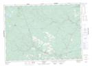
Stanley NTS Map Sheets