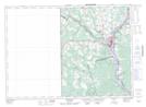
Maps showing The Gully, Carleton, New Brunswick
The Gully is a Valley located in Carleton, New Brunswick.
- Latitude: 46° 9' North (decimal: 46.1499999)
- Longitude: 67° 35' West (decimal: -67.5833000)
- Topography Feature Category: Valley
- Geographical Feature: Ravine
- Canadian Province/Territory: New Brunswick
- Location: Carleton
- Atlas of Canada Locator Map: The Gully
- GPS Coordinate Locator Map: The Gully Lat/Long
The Gully NTS Map Sheets