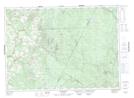
Maps showing Half Moon Pit, York, New Brunswick
Half Moon Pit is a Unincorporated area located in York, New Brunswick and has an elevation of 244 meters.
- Latitude: 46° 29' 14'' North (decimal: 46.4873487)
- Longitude: 67° 1' 29'' West (decimal: -67.0247929)
- Topography Feature Category: Unincorporated area
- Geographical Feature: Railway Point
- Canadian Province/Territory: New Brunswick
- Elevation: 244 meters
- Location: York
- Atlas of Canada Locator Map: Half Moon Pit
- GPS Coordinate Locator Map: Half Moon Pit Lat/Long
Half Moon Pit NTS Map Sheets