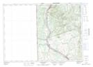
Maps showing Halls Corner, Carleton, New Brunswick
Halls Corner is a Unincorporated area located in Carleton, New Brunswick and has an elevation of 161 meters.
- Latitude: 46° 34' 29'' North (decimal: 46.5747211)
- Longitude: 67° 37' 2'' West (decimal: -67.6171198)
- Topography Feature Category: Unincorporated area
- Geographical Feature: Dispersed Rural Community
- Canadian Province/Territory: New Brunswick
- Elevation: 161 meters
- Location: Carleton
- Atlas of Canada Locator Map: Halls Corner
- GPS Coordinate Locator Map: Halls Corner Lat/Long
Halls Corner NTS Map Sheets