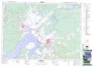
Maps showing Halls Hill, Westmorland, New Brunswick
Halls Hill is a Mountain located in Westmorland, New Brunswick and has an elevation of 31 meters.
- Latitude: 45° 57' 31'' North (decimal: 45.9584954)
- Longitude: 64° 11' 50'' West (decimal: -64.1973414)
- Topography Feature Category: Mountain
- Geographical Feature: Hill
- Canadian Province/Territory: New Brunswick
- Elevation: 31 meters
- Location: Westmorland
- Atlas of Canada Locator Map: Halls Hill
- GPS Coordinate Locator Map: Halls Hill Lat/Long