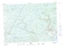
Maps showing Hardwood Ridge, Sunbury, New Brunswick
Hardwood Ridge is a Unincorporated area located in Sunbury, New Brunswick and has an elevation of 97 meters.
- Latitude: 46° 9' 16'' North (decimal: 46.1543921)
- Longitude: 66° 2' 16'' West (decimal: -66.0377509)
- Topography Feature Category: Unincorporated area
- Geographical Feature: Dispersed Rural Community
- Canadian Province/Territory: New Brunswick
- Elevation: 97 meters
- Location: Sunbury
- Atlas of Canada Locator Map: Hardwood Ridge
- GPS Coordinate Locator Map: Hardwood Ridge Lat/Long