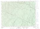
Maps showing Dave Richards Brook, Madawaska, New Brunswick
Dave Richards Brook is a River located in Madawaska, New Brunswick and has an elevation of 279 meters.
- Latitude: 47° 36' 56'' North (decimal: 47.6154613)
- Longitude: 67° 50' 16'' West (decimal: -67.8378884)
- Topography Feature Category: River
- Geographical Feature: Brook
- Canadian Province/Territory: New Brunswick
- Elevation: 279 meters
- Location: Madawaska
- Atlas of Canada Locator Map: Dave Richards Brook
- GPS Coordinate Locator Map: Dave Richards Brook Lat/Long
Dave Richards Brook NTS Map Sheets