Maps showing Devereaux, Gloucester, New Brunswick
Devereaux is a Unincorporated area located in Gloucester, New Brunswick and has an elevation of 10 meters.
- Latitude: 47° 49' 36'' North (decimal: 47.8267168)
- Longitude: 65° 44' 16'' West (decimal: -65.7376939)
- Topography Feature Category: Unincorporated area
- Geographical Feature: Dispersed Rural Community
- Canadian Province/Territory: New Brunswick
- Elevation: 10 meters
- Location: Gloucester
- Atlas of Canada Locator Map: Devereaux
- GPS Coordinate Locator Map: Devereaux Lat/Long
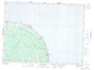
Devereaux NTS Map Sheets