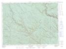
Maps showing Devils Elbow Rapids, Restigouche, New Brunswick
Devils Elbow Rapids is a Rapids located in Restigouche, New Brunswick and has an elevation of 294 meters.
- Latitude: 47° 57' 23'' North (decimal: 47.9565018)
- Longitude: 67° 55' 26'' West (decimal: -67.9238222)
- Topography Feature Category: Rapids
- Geographical Feature: Rapids
- Canadian Province/Territory: New Brunswick
- Elevation: 294 meters
- Location: Restigouche
- Atlas of Canada Locator Map: Devils Elbow Rapids
- GPS Coordinate Locator Map: Devils Elbow Rapids Lat/Long
Devils Elbow Rapids NTS Map Sheets