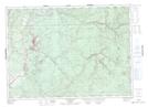
Maps showing Herb Days Lake, Victoria, New Brunswick
Herb Days Lake is a Lake located in Victoria, New Brunswick and has an elevation of 165 meters.
- Latitude: 46° 52' 31'' North (decimal: 46.8752254)
- Longitude: 67° 24' 7'' West (decimal: -67.4020445)
- Topography Feature Category: Lake
- Geographical Feature: Lake
- Canadian Province/Territory: New Brunswick
- Elevation: 165 meters
- Location: Victoria
- Atlas of Canada Locator Map: Herb Days Lake
- GPS Coordinate Locator Map: Herb Days Lake Lat/Long
Herb Days Lake NTS Map Sheets