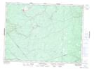
Maps showing Herman Goods Meadow, Gloucester, New Brunswick
Herman Goods Meadow is a Low vegetation located in Gloucester, New Brunswick and has an elevation of 216 meters.
- Latitude: 47° 23' North (decimal: 47.3832999)
- Longitude: 65° 52' West (decimal: -65.8666999)
- Topography Feature Category: Low vegetation
- Geographical Feature: Meadow
- Canadian Province/Territory: New Brunswick
- Elevation: 216 meters
- Location: Gloucester
- Atlas of Canada Locator Map: Herman Goods Meadow
- GPS Coordinate Locator Map: Herman Goods Meadow Lat/Long
Herman Goods Meadow NTS Map Sheets