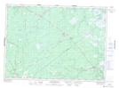
Maps showing The Horseback, Kent, New Brunswick
The Horseback is a Mountain located in Kent, New Brunswick and has an elevation of 42 meters.
- Latitude: 46° 50' 21'' North (decimal: 46.8392278)
- Longitude: 65° 6' 19'' West (decimal: -65.1052101)
- Topography Feature Category: Mountain
- Geographical Feature: Ridge
- Canadian Province/Territory: New Brunswick
- Elevation: 42 meters
- Location: Kent
- Atlas of Canada Locator Map: The Horseback
- GPS Coordinate Locator Map: The Horseback Lat/Long
The Horseback NTS Map Sheets