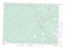
Maps showing Horton Brook, Kent, New Brunswick
Horton Brook is a River located in Kent, New Brunswick and has an elevation of 71 meters.
- Latitude: 46° 22' 1'' North (decimal: 46.3668488)
- Longitude: 65° 21' 57'' West (decimal: -65.3657408)
- Topography Feature Category: River
- Geographical Feature: Brook
- Canadian Province/Territory: New Brunswick
- Elevation: 71 meters
- Location: Kent
- Atlas of Canada Locator Map: Horton Brook
- GPS Coordinate Locator Map: Horton Brook Lat/Long