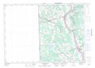
Maps showing Hunters Corner, Carleton, New Brunswick
Hunters Corner is a Unincorporated area located in Carleton, New Brunswick and has an elevation of 134 meters.
- Latitude: 46° 26' 21'' North (decimal: 46.4391545)
- Longitude: 67° 40' 14'' West (decimal: -67.6706215)
- Topography Feature Category: Unincorporated area
- Geographical Feature: Dispersed Rural Community
- Canadian Province/Territory: New Brunswick
- Elevation: 134 meters
- Location: Carleton
- Atlas of Canada Locator Map: Hunters Corner
- GPS Coordinate Locator Map: Hunters Corner Lat/Long
Hunters Corner NTS Map Sheets