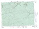
Maps showing Jacquet River Lakes, Restigouche, New Brunswick
Jacquet River Lakes is a Lake located in Restigouche, New Brunswick and has an elevation of 318 meters.
- Latitude: 47° 39' 27'' North (decimal: 47.6575727)
- Longitude: 66° 24' 57'' West (decimal: -66.4159314)
- Topography Feature Category: Lake
- Geographical Feature: Lakes
- Canadian Province/Territory: New Brunswick
- Elevation: 318 meters
- Location: Restigouche
- Atlas of Canada Locator Map: Jacquet River Lakes
- GPS Coordinate Locator Map: Jacquet River Lakes Lat/Long
Jacquet River Lakes NTS Map Sheets