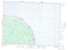
Maps showing Jacquet River Provincial Park, Restigouche, New Brunswick
Jacquet River Provincial Park is a Conservation area located in Restigouche, New Brunswick and has an elevation of 17 meters.
- Latitude: 47° 55' 10'' North (decimal: 47.9193268)
- Longitude: 65° 59' 16'' West (decimal: -65.9877129)
- Topography Feature Category: Conservation area
- Geographical Feature: Provincial Park
- Canadian Province/Territory: New Brunswick
- Elevation: 17 meters
- Location: Restigouche
- GPS Coordinate Locator Map: Jacquet River Provincial Park Lat/Long
Jacquet River Provincial Park NTS Map Sheets