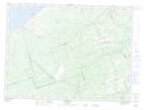
Maps showing Janeville, Gloucester, New Brunswick
Janeville is a Unincorporated area located in Gloucester, New Brunswick and has an elevation of 17 meters.
- Latitude: 47° 41' 16'' North (decimal: 47.687736)
- Longitude: 65° 26' 5'' West (decimal: -65.4347951)
- Topography Feature Category: Unincorporated area
- Geographical Feature: Railway Point
- Canadian Province/Territory: New Brunswick
- Elevation: 17 meters
- Location: Gloucester
- Atlas of Canada Locator Map: Janeville
- GPS Coordinate Locator Map: Janeville Lat/Long
Janeville NTS Map Sheets