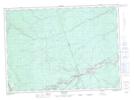
Maps showing The Jaws, Northumberland, New Brunswick
The Jaws is a Channel located in Northumberland, New Brunswick and has an elevation of 196 meters.
- Latitude: 46° 39' 56'' North (decimal: 46.6656378)
- Longitude: 66° 23' 33'' West (decimal: -66.3925791)
- Topography Feature Category: Channel
- Geographical Feature: Narrows
- Canadian Province/Territory: New Brunswick
- Elevation: 196 meters
- Location: Northumberland
- Atlas of Canada Locator Map: The Jaws
- GPS Coordinate Locator Map: The Jaws Lat/Long