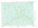
Maps showing The Jaws, York, New Brunswick
The Jaws is a Rapids located in York, New Brunswick and has an elevation of 310 meters.
- Latitude: 46° 39' 56'' North (decimal: 46.6655607)
- Longitude: 66° 38' 50'' West (decimal: -66.6471238)
- Topography Feature Category: Rapids
- Geographical Feature: Rapids
- Canadian Province/Territory: New Brunswick
- Elevation: 310 meters
- Location: York
- Atlas of Canada Locator Map: The Jaws
- GPS Coordinate Locator Map: The Jaws Lat/Long
The Jaws NTS Map Sheets