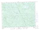
Maps showing The Jaws, Victoria, New Brunswick
The Jaws is a Channel located in Victoria, New Brunswick and has an elevation of 404 meters.
- Latitude: 46° 54' 25'' North (decimal: 46.9070155)
- Longitude: 66° 46' 24'' West (decimal: -66.7733109)
- Topography Feature Category: Channel
- Geographical Feature: Narrows
- Canadian Province/Territory: New Brunswick
- Elevation: 404 meters
- Location: Victoria
- Atlas of Canada Locator Map: The Jaws
- GPS Coordinate Locator Map: The Jaws Lat/Long
The Jaws NTS Map Sheets