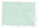
Maps showing Lac de Bon-Secours, Kent, New Brunswick
Lac de Bon-Secours is a Lake located in Kent, New Brunswick and has an elevation of 81 meters.
- Latitude: 46° 23' 12'' North (decimal: 46.3866056)
- Longitude: 65° 1' 39'' West (decimal: -65.0275326)
- Topography Feature Category: Lake
- Geographical Feature: Lac
- Canadian Province/Territory: New Brunswick
- Elevation: 81 meters
- Location: Kent
- Atlas of Canada Locator Map: Lac de Bon-Secours
- GPS Coordinate Locator Map: Lac de Bon-Secours Lat/Long