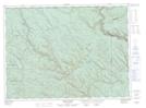
Maps showing Kedgwick Forks, Restigouche, New Brunswick
Kedgwick Forks is a River feature located in Restigouche, New Brunswick and has an elevation of 254 meters.
- Latitude: 47° 54' 28'' North (decimal: 47.9077385)
- Longitude: 67° 54' 25'' West (decimal: -67.9069820)
- Topography Feature Category: River feature
- Geographical Feature: Forks
- Canadian Province/Territory: New Brunswick
- Elevation: 254 meters
- Location: Restigouche
- Atlas of Canada Locator Map: Kedgwick Forks
- GPS Coordinate Locator Map: Kedgwick Forks Lat/Long
Kedgwick Forks NTS Map Sheets