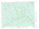
Maps showing Kettle Falls, York, New Brunswick
Kettle Falls is a Falls located in York, New Brunswick and has an elevation of 236 meters.
- Latitude: 46° 36' 30'' North (decimal: 46.6084445)
- Longitude: 66° 44' 53'' West (decimal: -66.7479466)
- Topography Feature Category: Falls
- Geographical Feature: Falls
- Canadian Province/Territory: New Brunswick
- Elevation: 236 meters
- Location: York
- Atlas of Canada Locator Map: Kettle Falls
- GPS Coordinate Locator Map: Kettle Falls Lat/Long
Kettle Falls NTS Map Sheets