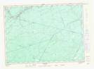
Maps showing East Branch Gordon Brook, Sunbury, New Brunswick
East Branch Gordon Brook is a River located in Sunbury, New Brunswick and has an elevation of 115 meters.
- Latitude: 46° 21' 3'' North (decimal: 46.3507033)
- Longitude: 66° 10' 9'' West (decimal: -66.1691915)
- Topography Feature Category: River
- Geographical Feature: Branch
- Canadian Province/Territory: New Brunswick
- Elevation: 115 meters
- Location: Sunbury
- Atlas of Canada Locator Map: East Branch Gordon Brook
- GPS Coordinate Locator Map: East Branch Gordon Brook Lat/Long
East Branch Gordon Brook NTS Map Sheets